Russell Pier is a recent graduate of The University of Akron. This article summarizes Pier’s project for his MA in Applied History and Public Humanities, done in collaboration with Summit Metro Parks.
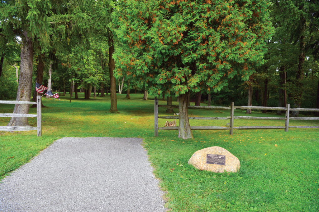
Within the Tallmadge Meadows Area of Munroe Falls Metro Park lies a cemetery, surrounded by woods and maintained by the park district. The cemetery served as the final resting place for residents of the Summit County Home, which housed those who were impoverished, in need of mental care or physical rehabilitation, or had nobody else to care for them. The home operated from 1921 to 1970 and was razed in 1978. Some records from the Summit County Home suggest there are 900 or more burials in the cemetery. While we only know the names of a handful of the people buried there, there are methods available to help determine the precise boundaries of the cemetery (which have become blurred over time), how many graves there are and where the residents were buried.


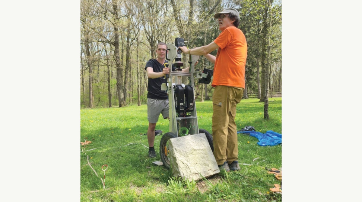
To obtain some of this information, the cemetery was the focus of a minimally invasive archaeological survey in 2024 that used three overlapping techniques. The use of multiple survey techniques over the known boundary area of the cemetery garnered more reliable and precise results than using any single technique. The first was human remains detection dogs (HRDs). As their name suggests, these highly trained dogs can detect the scent of human remains. The second was ground penetrating radar (GPR), which can help reveal disturbed soil, indicating a possible burial. GPR is effective in covering large areas, ideal for the mowed area of the cemetery. The third was subsurface soil spectroscopy (Subterra Grey), which can also help detect disturbed soil as well as fatty acids from human remains. Once the data was collected, it was mapped to coordinate different collection techniques and display the results.

The survey showed that rows of currently unmarked graves line the cemetery area. Potentially, these rows extend into the woods to the north and east. This is shown by rows continuing outside of the area surveyed, suggesting a larger cemetery than the current boundary. The exact number of graves has not yet been determined, however, knowing where the graves are can help the park district in the continued preservation of what remains of the cemetery. Though we can now identify where burials are most likely to be, unfortunately, it is not possible to match names and burials with the archaeological and historical information available.
For more stories like this, check out Green Islands magazine, a bi-monthly publication from Summit Metro Parks. Summit County residents can sign up to receive the publication at home free of charge.