One of the most important tasks in cultural resource management is meticulous record keeping. This isn’t just taking notes, but also taking photographs, gathering samples, making maps and creating accurate technical drawings.
Such methods are used in historic preservation to assess the historic integrity of a standing structure or to record its conditions prior, during and after restoration work. In archaeology, detailed documentation is especially important because the process of excavation effectively destroys the resource. In other words, once something is dug, it can never be dug again. So, it is imperative that archaeologists record everything possible so that every step of the excavation can be understood through the documentation.
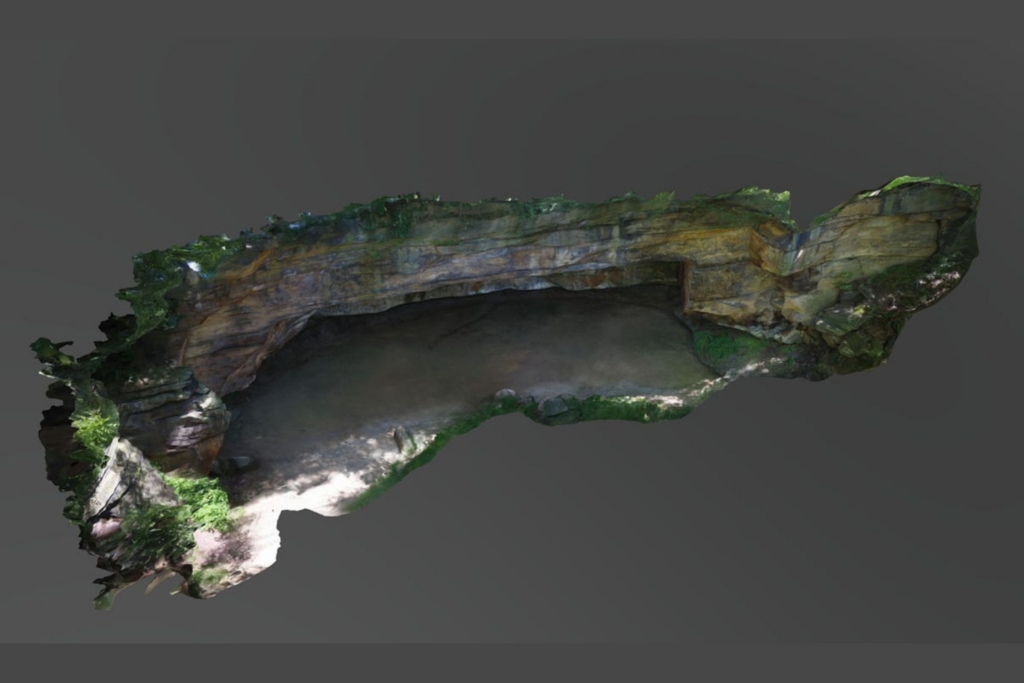
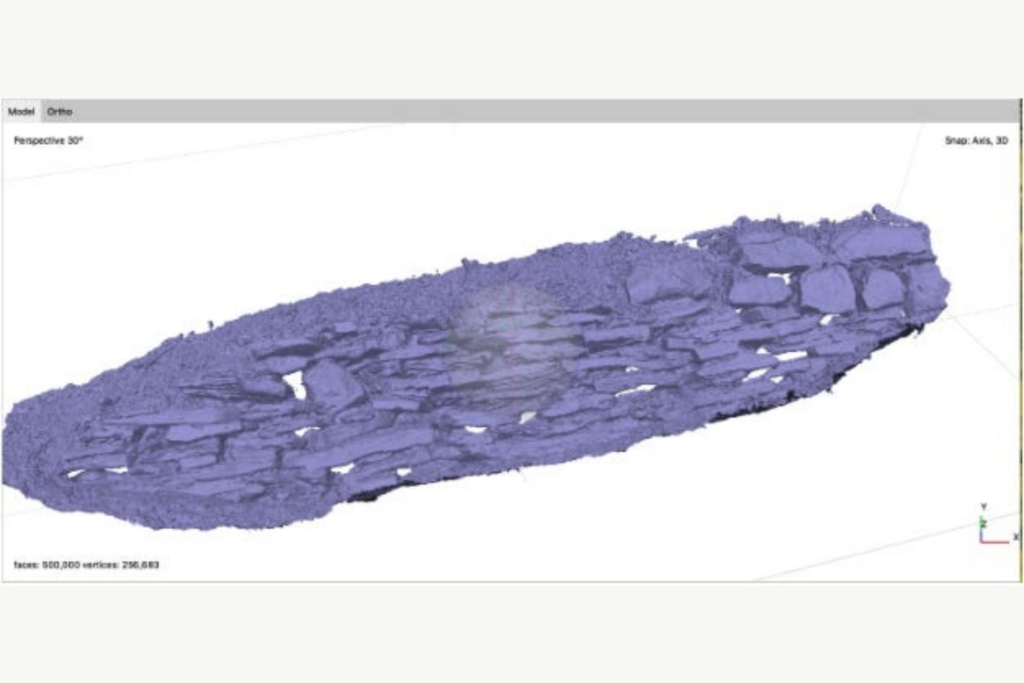
Thanks to advancements in imaging technology, a relatively new method of recording is becoming common in cultural resource management: photogrammetry. Photogrammetry is the technique of creating accurate measurements from photographs through the creation of 3D, high-resolution models. These models can be made of anything from small objects to landscapes.
There are two types of photogrammetry: aerial and close range. Aerial photogrammetry utilizes a series of photographs taken by drones to generate 3D maps of a landscape. Close-range photogrammetry uses handheld cameras to record spaces and objects. After the photographs have been collected, the results are generated in the same way.
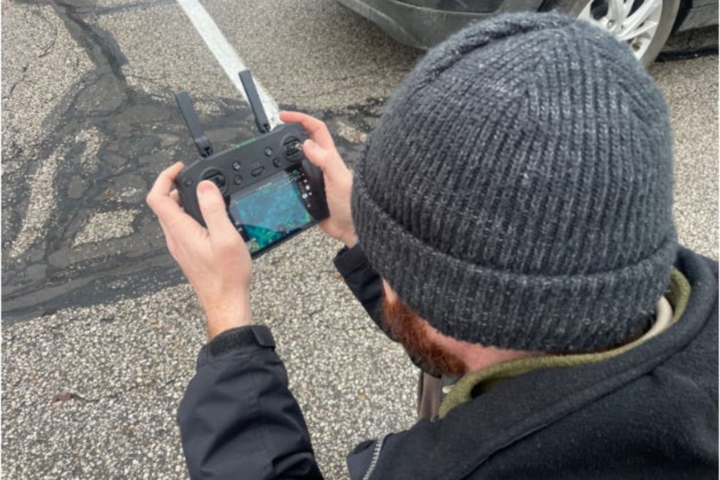
The photographs are imported into photogrammetry software and the software stitches them together using the locational and camera orientation information stored in the metadata. There are several software options available today, and different ones are used depending on the project. There are even smartphone apps, like Polycam, that can create accurate models within minutes.
With assistance from Dr. Jerrad Lancaster of The University of Akron Department of Anthropology, Summit Metro Parks began using aerial and close-range photogrammetry in 2018 to record above ground cultural resources within the park district and some of the park district’s archaeological investigations as they happened. Models were created for the 2019 archaeological excavation of Old Maid’s Kitchen in Gorge Metro Park, the exterior of Himelright Lodge prior to its renovation, and the George Conrad and Willie Mae Prather House site at the Valley View Area of Cascade Valley Metro Park. Summit Metro Park’s cultural resources staff have continued to use photogrammetry on sites and projects, including modeling artifacts from the parks’ archaeological collection.
Summit Metro Parks also uses photogrammetry for natural resource management projects. In 2024 a new wetland was created at the North Hawkins parking lot in Sand Run Metro Park as part of mitigation for the Gorge Dam removal project. Park staff conducted aerial photogrammetry of the site after construction and the model will be used to monitor the wetland’s conditions and natural development over time.
In 2023, University of Akron students in Dr. Shanon Donnelly’s Geosciences Service-Learning class led a study of invasive phragmites australis in Long Lake at the Confluence Area of Firestone Metro Park. The students used photogrammetry techniques to record inaccessible areas of the park to map the phragmites so that park staff can track and control its spread. You can learn more about the project through the students’ storymap page.
Photogrammetry is a useful tool for various conservation projects. Although this technology has been in use for several years at Summit Metro Parks, only recently have these models been published online for the public to view and interact with. Now you can access the models on the Summit Metro Parks Sketchfab page from your computer or phone.
Check back regularly or follow our page on Sketchfab to see new models as they are added. They are organized by subject, project and park.