What is now Freedom Trail was once an abandoned rail corridor owned by METRO Regional Transit Authority that has turned into a beautiful multipurpose trail for the public to enjoy. Also known as the Freedom Secondary Line once owned by Conrail, the entire corridor spans from Akron near E.J. Thomas Hall at The University of Akron and travels northeast through Akron, Tallmadge, near Munroe Falls Metro Park and ends at Middlebury Road in Kent.
The Portage Hike & Bike Trail, which starts at Middlebury Road, is a multi-jurisdictional trail project that travels east, with portions of the trail managed by Portage Park District, the City of Kent, City of Ravenna and Kent State University.
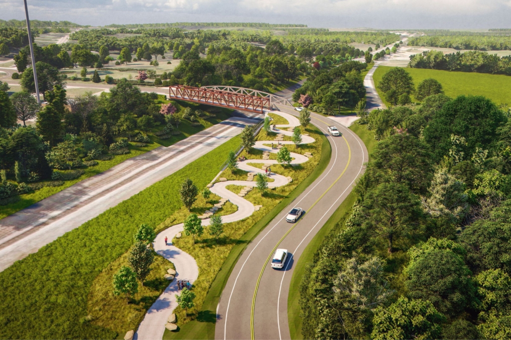
The problem was the short 0.3-mile gap between the two trails, complicated by a winding road and railroad tracks, making it difficult and unsafe for users to travel between them. This new connection creates a seamless and safe route for continuous travel east or west.

Creating Freedom Trail took a lot of coordination between Summit Metro Parks and local partners including the City of Kent, Akron Metropolitan Area Transportation Study (AMATS), Ohio Department of Transportation (ODOT), First Energy, CSX Railroad and Portage County Engineer, as well as private property owners in a small area. Summit Metro Parks is grateful for this cooperation that has allowed us to bring connections to life.
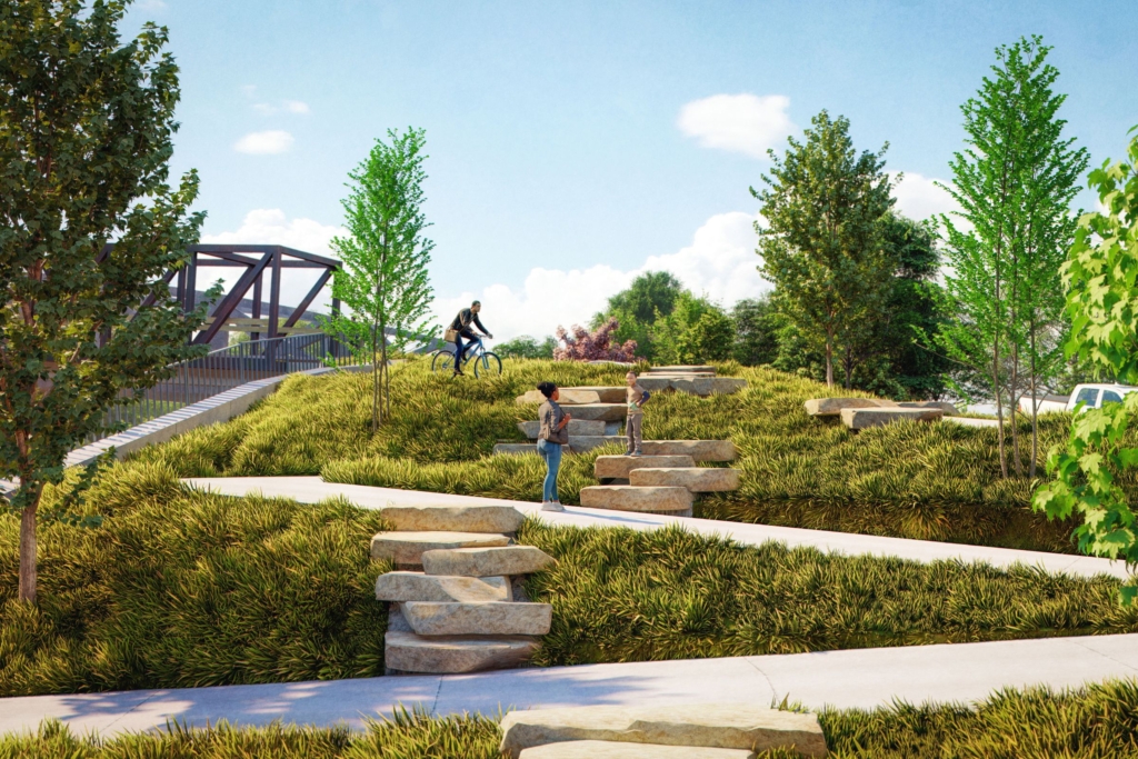
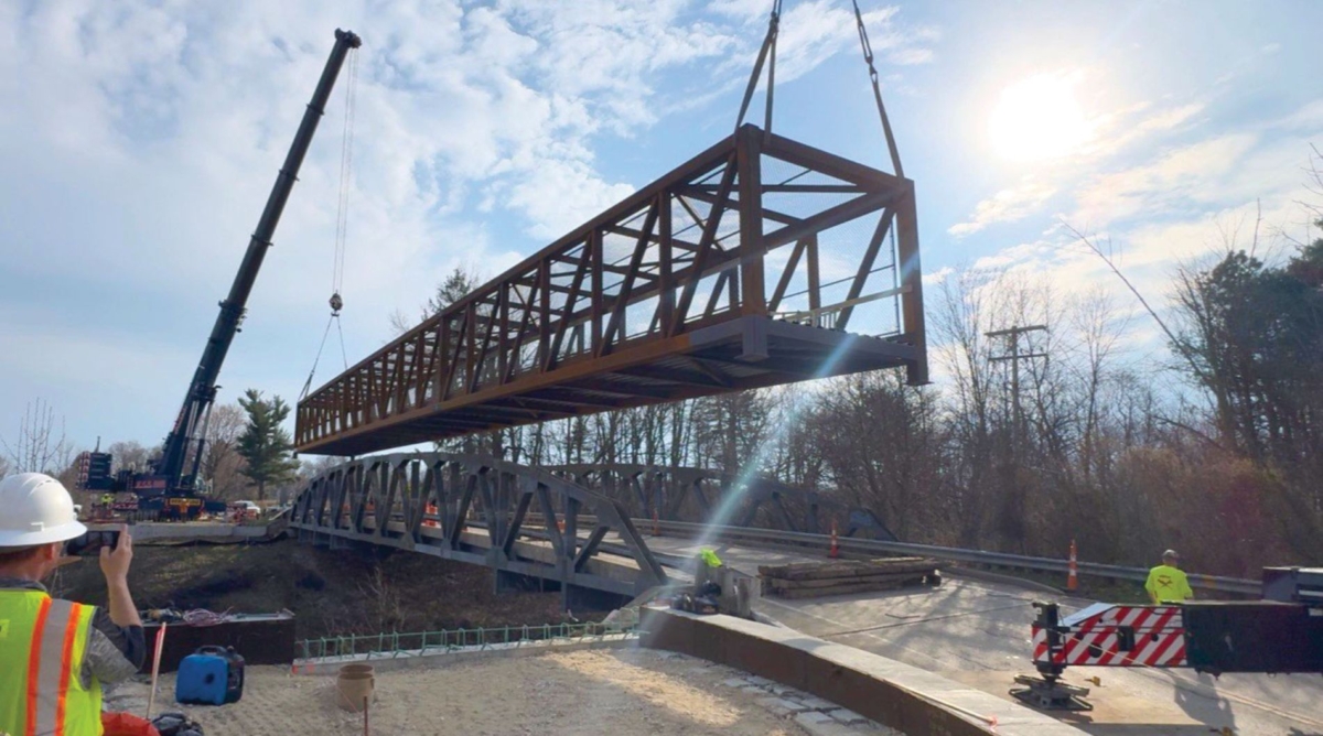
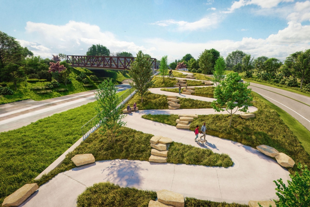
We have completed a short multi-purpose connector between the two trails, consisting of a 10-foot-wide asphalt path with switchbacks and a bridge over the railroad corridor built to American with Disabilities Act (ADA) standards. The project makes a safe off-road connection between the two existing trails. The project was paid for using the park district’s general fund along with several different local, state and federal grants.
Currently, eight miles of Freedom Trail is open to the public from Middlebury Road to Mill Street. Another 1-mile section is currently under construction from Mill Street to Buchtel Avenue in downtown Akron, leaving a small section to complete in the near future to reach the Towpath Trail. Both trails connect schools, businesses and parks with downtowns and neighborhoods from Akron to Kent. The connector trail between the two trails will be a major benefit to the region, making one of the largest east-west trails in Northeast Ohio! Come on out and hike or ride a little (or a lot) of the trail.
For more stories like this, check out Green Islands magazine, a bi-monthly publication from Summit Metro Parks. Summit County residents can sign up to receive the publication at home free of charge.